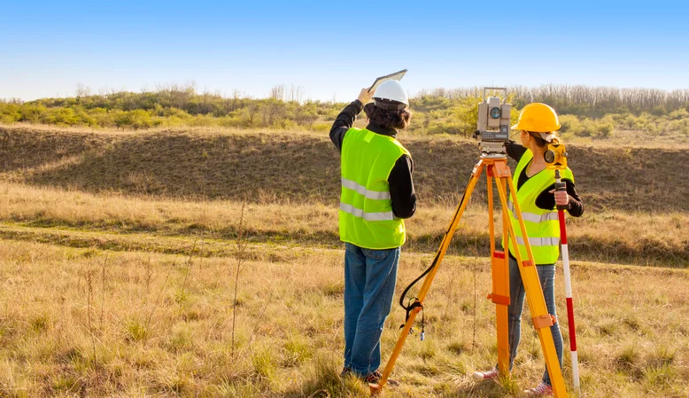
Land surveying often flies under the radar when people consider important careers. It’s easy to picture engineers sketching blueprints or architects drafting buildings, but none of that happens without a surveyor first defining the boundaries. At first glance, surveying might seem like a job filled with numbers, maps, and measuring tools. But there’s far more happening beyond the theodolite.
Within the first few weeks on the job, a land surveyor could find themselves standing in a dense forest, knee-deep in a creek, or scaling a rocky hillside. Unlike other professions tied to a desk, land surveying jobs often blend adventure with precision. From construction sites to untouched landscapes, the variety keeps the role dynamic and mentally engaging.
Defining Legal Boundaries
One of the most important tasks of a surveyor is determining where property begins and ends. These boundary lines are essential for avoiding disputes and ensuring legal compliance. Before construction starts on a home, a road, or a high-rise building, a surveyor must identify the exact coordinates that define the land’s edges.
This work ensures that neighbors don’t accidentally build on someone else’s property. It also plays a major role in subdividing large parcels of land for development. A small mistake in this step could lead to expensive legal battles later. Precision matters.
Supporting Urban Development
Modern cities rely heavily on accurate land data. Whether it’s planning underground pipelines or laying out streets, surveyors provide the foundation. Their measurements influence how a city grows and evolves. Every sidewalk, utility line, and intersection begins with surveying data.
Even landscaping around commercial buildings is shaped by this profession. Architects and developers look to surveyors for accurate topographical data. It helps them make decisions about grading, drainage, and structural placement. Their input affects both design and safety.
Partnering with Cutting-Edge Technology
Surveying today uses far more than a simple tape measure. Professionals rely on GPS systems, drones, 3D scanners, and software that processes geographic information. This technology helps them capture detailed measurements faster and with greater accuracy.
Drones, for instance, can survey large or hard-to-reach areas in a fraction of the time. This is especially useful for infrastructure projects or mapping coastal zones. Surveyors also use laser scanning tools to produce high-resolution images of terrain. It’s a mix of engineering, cartography, and tech all rolled into one.
Environmental and Historical Projects
Surveying isn’t limited to construction and development. Professionals often assist in preserving national parks, restoring historical landmarks, and managing forests. By documenting changes in terrain or marking ancient boundary lines, their work supports conservation and education.
In archaeological sites, surveyors play a key role in mapping excavation areas. This ensures accurate documentation and preservation of valuable findings. In areas prone to flooding or erosion, they monitor elevation changes that could signal larger environmental issues.
Every Project is a New Puzzle
Each assignment comes with unique challenges. A project in the desert will have very different obstacles compared to one in a busy metropolitan area. Weather, terrain, and access can vary wildly from one location to another.
This keeps the work fresh and mentally stimulating. Surveyors must adapt quickly and make decisions based on field conditions. Problem-solving is constant, and teamwork is essential. For those who enjoy challenges that require both physical effort and mental calculation, surveying is a perfect match.
Why the Excitement is Real
Land surveying may not sound thrilling at first, but its day-to-day work tells a different story. From discovering historical land markers to flying drones over remote landscapes, there’s always something new to learn and explore. It’s a career that combines science, math, technology, and exploration in ways that few others can.
Anyone curious about the built environment, geography, or spatial technology will find plenty of reasons to be drawn in. The journey from training to expertise can be challenging, but it’s never boring. For those ready to get their boots muddy and their brains working, this is a path worth following. In the end, land surveying jobs not just provide a paycheck, they offer a front-row seat to how the world is shaped and reshaped every day.
